The interactive Abruzzo map on this page showcases all the region’s principal tourist destinations and points of interest. You can view art cities, ski resorts, beaches, coastal villages and other tourist spots, as well as landmarks such as the Abruzzo airport.
Zoom in or pan with your mouse to find the perfect destination for your dream holiday! Bookmark this page so you’ll always have this useful mapat your fingertips.
Where is Abruzzo located
Click to enlarge
Abruzzo is a region in central-southern Italy located between the central Apennines and the Adriatic Sea across a territory that is 65% mountainous, 34% hilly, and just 1% flat. The inland zone, home to the high Apennine peaks, is separated from the coastal area by the Maiella and Gran Sasso mountain chains.
The journey from the most mountainous areas down to the seaside resorts is characterised by ancient villages and territories steeped in history and tradition. The region borders the Marche to the north, Lazio to the west, Molise to the south and the Adriatic Sea to the east.
Abruzzo’s provinces
Administratively, Abruzzo comprises four provinces: L’Aquila, the regional capital, Teramo, Pescara and Chieti. L’Aquila province is the largest and covers approximately half the region’s territory.
 Airport
 Attraction
 Citta
Citta Landscape
 Village
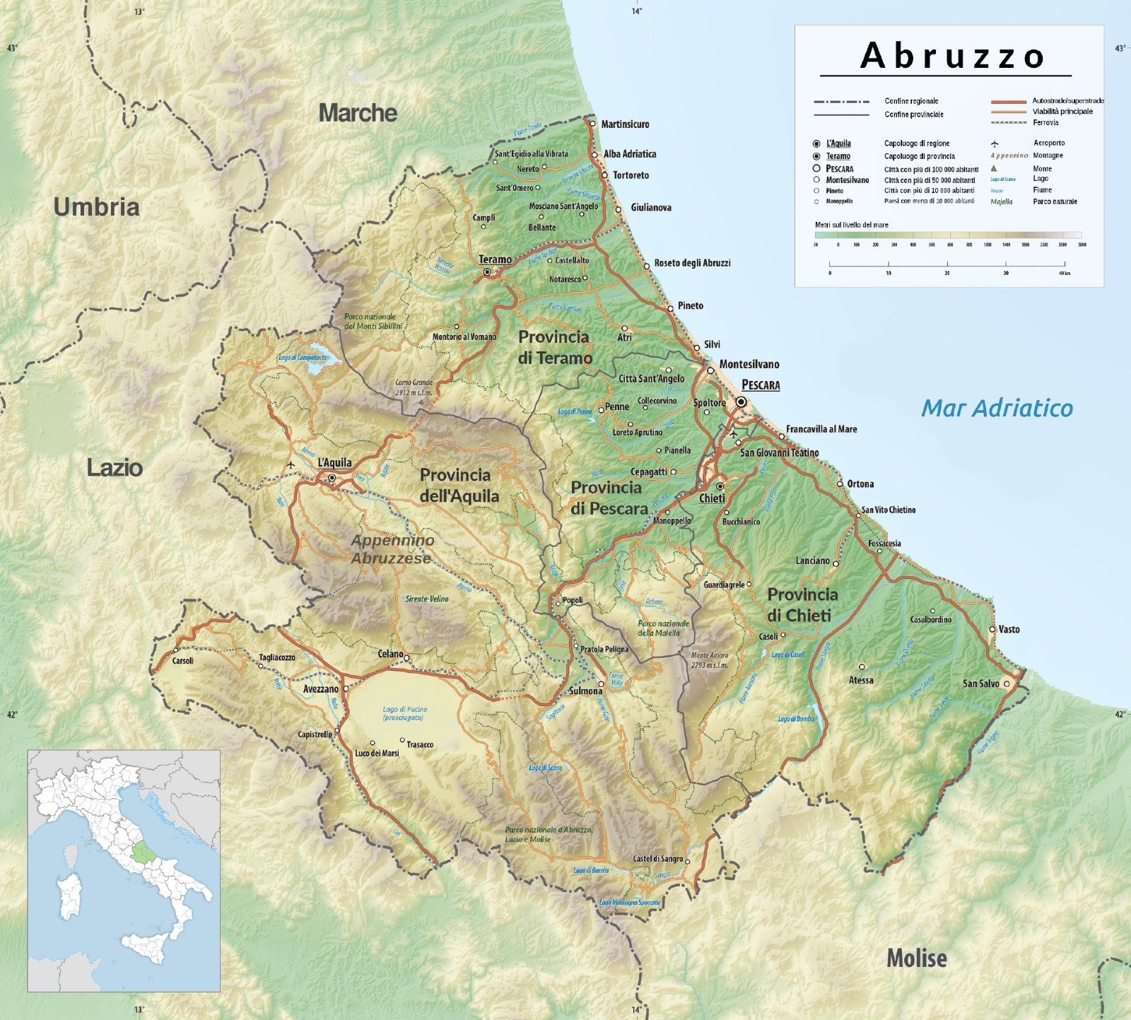
 Hotel
Hotel  Budget accommodations
  Apartments
  Family Hotel
  Luxury Hotel
  Resorts